


Enterré G3 2024

LouisROGER
User GUIDE
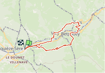

Length
9.2 km

Max alt
1148 m

Uphill gradient
564 m
Km-Effort
16.7 km

Min alt
757 m

Downhill gradient
563 m
Boucle
Yes
Creation date :
2024-03-01 08:37:22.937
Updated on :
2024-03-01 14:18:47.923
5h40
Difficulty : Difficult

FREE GPS app for hiking
 SityTrail
IGN / Geographical institutes
SityTrail Plus
The world is yours!
About
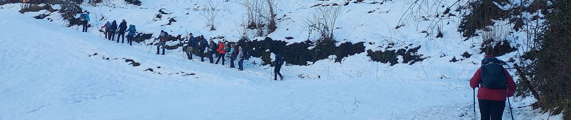
Trail Walking of 9.2 km to be discovered at Occitania, Hautespyrenees, Esterre. This trail is proposed by LouisROGER.
Photos


Positioning
Country:
France
Region :
Occitania
Department/Province :
Hautespyrenees
Municipality :
Esterre
Location:
Unknown
Start:(Dec)
Start:(UTM)
255507 ; 4751312 (31T) N.
Comments