


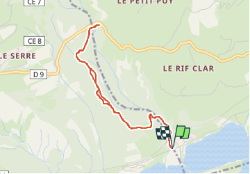
route des puys

jmgeffrin
User

Length
4.5 km

Max alt
1053 m

Uphill gradient
251 m
Km-Effort
7.8 km

Min alt
791 m

Downhill gradient
251 m
Boucle
Yes
Creation date :
2024-03-02 08:47:21.329
Updated on :
2024-03-02 10:03:18.859
1h15
Difficulty : Medium

FREE GPS app for hiking
 SityTrail
IGN / Geographical institutes
SityTrail Plus
The world is yours!
About
Trail Walking of 4.5 km to be discovered at Provence-Alpes-Côte d'Azur, Hautes-Alpes, Embrun. This trail is proposed by jmgeffrin.
Positioning
Country:
France
Region :
Provence-Alpes-Côte d'Azur
Department/Province :
Hautes-Alpes
Municipality :
Embrun
Location:
Unknown
Start:(Dec)
Start:(UTM)
298691 ; 4935957 (32T) N.
Comments