


fhkyr

Clo0413
User
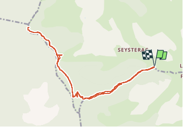

Length
11.4 km

Max alt
1212 m

Uphill gradient
663 m
Km-Effort
20 km

Min alt
756 m

Downhill gradient
663 m
Boucle
Yes
Creation date :
2024-03-04 08:50:36.697
Updated on :
2024-03-04 14:52:02.264
3h39
Difficulty : Very difficult

FREE GPS app for hiking
 SityTrail
IGN / Geographical institutes
SityTrail Plus
The world is yours!
About
Trail Walking of 11.4 km to be discovered at Provence-Alpes-Côte d'Azur, Alpes-de-Haute-Provence, Thoard. This trail is proposed by Clo0413.
Positioning
Country:
France
Region :
Provence-Alpes-Côte d'Azur
Department/Province :
Alpes-de-Haute-Provence
Municipality :
Thoard
Location:
Unknown
Start:(Dec)
Start:(UTM)
268404 ; 4890447 (32T) N.
Comments