


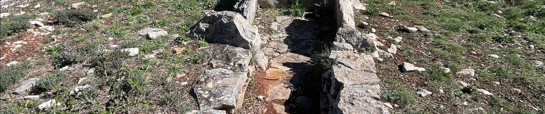
Cabasse le dolmen

michelpaulin
User
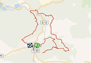

Length
14.9 km

Max alt
344 m

Uphill gradient
478 m
Km-Effort
21 km

Min alt
188 m

Downhill gradient
478 m
Boucle
Yes
Creation date :
2024-03-05 08:46:58.0
Updated on :
2024-03-05 15:06:50.202

FREE GPS app for hiking
 SityTrail
IGN / Geographical institutes
SityTrail Plus
The world is yours!
About
Trail of 14.9 km to be discovered at Provence-Alpes-Côte d'Azur, Var, Cabasse. This trail is proposed by michelpaulin.
Description
Belle rando sous le soleil
Photos


Positioning
Country:
France
Region :
Provence-Alpes-Côte d'Azur
Department/Province :
Var
Municipality :
Cabasse
Location:
Unknown
Start:(Dec)
Start:(UTM)
275053 ; 4811604 (32T) N.
Comments