


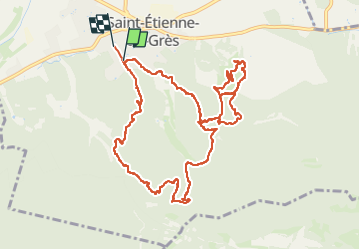
2024..03.07 - St-Etienne-du-Grès 2

rando30129
User

Length
13 km

Max alt
164 m

Uphill gradient
363 m
Km-Effort
17.8 km

Min alt
21 m

Downhill gradient
366 m
Boucle
No
Creation date :
2024-03-07 12:24:53.0
Updated on :
2024-03-07 15:52:03.22
3h26
Difficulty : Difficult

FREE GPS app for hiking
 SityTrail
IGN / Geographical institutes
SityTrail Plus
The world is yours!
About
Trail Walking of 13 km to be discovered at Provence-Alpes-Côte d'Azur, Bouches-du-Rhône, Saint-Étienne-du-Grès. This trail is proposed by rando30129.
Positioning
Country:
France
Region :
Provence-Alpes-Côte d'Azur
Department/Province :
Bouches-du-Rhône
Municipality :
Saint-Étienne-du-Grès
Location:
Unknown
Start:(Dec)
Start:(UTM)
638912 ; 4848586 (31T) N.
Comments