


PR_56_La-Chapelle-Neuve_AA_01_Floranges_Circuit3b_20240307

patrickdanilo
User
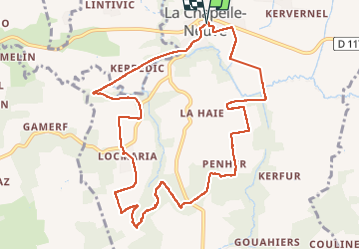

Length
10.9 km

Max alt
120 m

Uphill gradient
160 m
Km-Effort
13.1 km

Min alt
37 m

Downhill gradient
162 m
Boucle
Yes
Creation date :
2024-03-07 13:24:00.181
Updated on :
2025-07-27 15:02:12.029
2h58
Difficulty : Difficult

FREE GPS app for hiking
 SityTrail
IGN / Geographical institutes
SityTrail Plus
The world is yours!
About
Trail Walking of 10.9 km to be discovered at Brittany, Morbihan, La Chapelle-Neuve. This trail is proposed by patrickdanilo.
Description
Randonnée Marche de 10,9 km à découvrir à Bretagne, Morbihan, La Chapelle-Neuve. Cette randonnée est proposée par patrickdanilo.
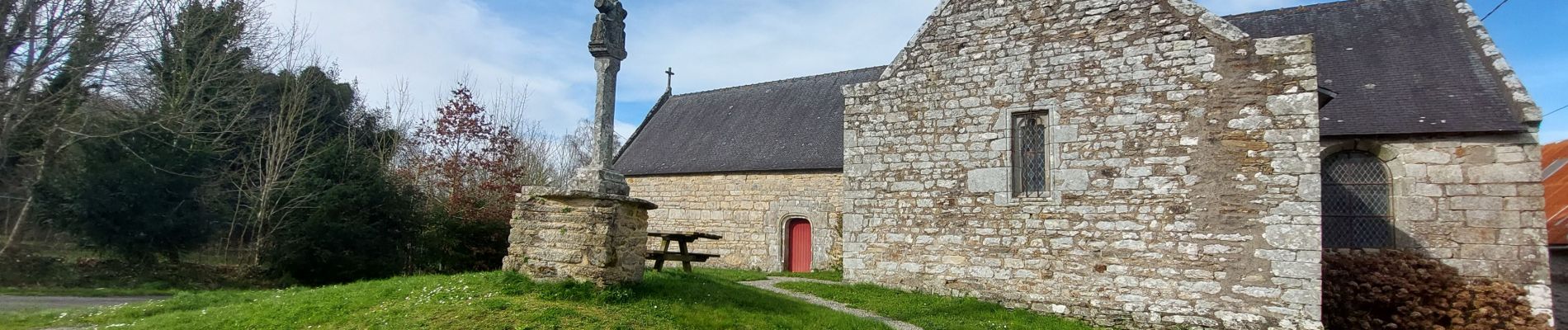
Photos


Positioning
Country:
France
Region :
Brittany
Department/Province :
Morbihan
Municipality :
La Chapelle-Neuve
Location:
Unknown
Start:(Dec)
Start:(UTM)
504354 ; 5301221 (30T) N.
Comments