


JPS Monts Aurélien-17655561

affinetataille
User GUIDE


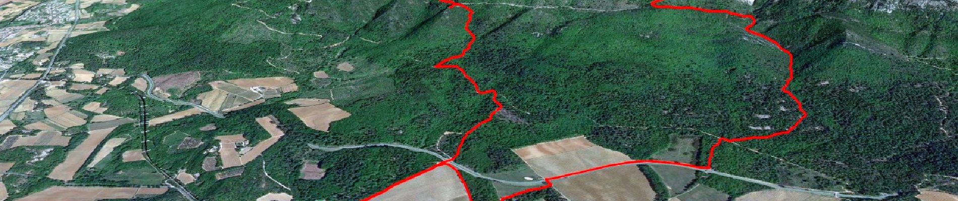
Length
17.3 km

Max alt
875 m

Uphill gradient
757 m
Km-Effort
27 km

Min alt
302 m

Downhill gradient
758 m
Boucle
Yes
Creation date :
2024-03-07 16:22:54.571
Updated on :
2024-04-26 16:11:51.271
7h00
Difficulty : Medium

FREE GPS app for hiking
 SityTrail
IGN / Geographical institutes
SityTrail Plus
The world is yours!
About
Trail Walking of 17.3 km to be discovered at Provence-Alpes-Côte d'Azur, Var, Pourrières. This trail is proposed by affinetataille.
Photos


35 photos in total. Please click on a photo to see them all in the gallery.
Positioning
Country:
France
Region :
Provence-Alpes-Côte d'Azur
Department/Province :
Var
Municipality :
Pourrières
Location:
Unknown
Start:(Dec)
Start:(UTM)
722097 ; 4816344 (31T) N.
Comments