


St Remy - les baux V2

ARPF
User
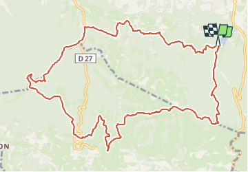

Length
14.4 km

Max alt
304 m

Uphill gradient
377 m
Km-Effort
19.5 km

Min alt
97 m

Downhill gradient
387 m
Boucle
Yes
Creation date :
2024-03-07 16:38:55.51
Updated on :
2024-03-07 22:15:14.661
4h25
Difficulty : Very difficult

FREE GPS app for hiking
 SityTrail
IGN / Geographical institutes
SityTrail Plus
The world is yours!
About
Trail Walking of 14.4 km to be discovered at Provence-Alpes-Côte d'Azur, Bouches-du-Rhône, Saint-Rémy-de-Provence. This trail is proposed by ARPF.
Positioning
Country:
France
Region :
Provence-Alpes-Côte d'Azur
Department/Province :
Bouches-du-Rhône
Municipality :
Saint-Rémy-de-Provence
Location:
Unknown
Start:(Dec)
Start:(UTM)
647035 ; 4847810 (31T) N.
Comments