


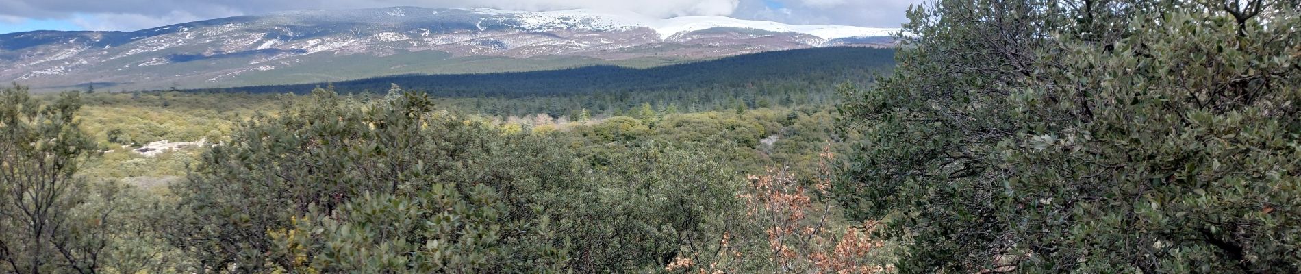
Sentiers sauvages de la Combe Ripert

supercolas
User GUIDE
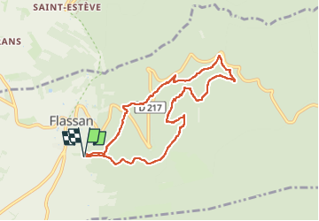

Length
8.5 km

Max alt
726 m

Uphill gradient
373 m
Km-Effort
13.5 km

Min alt
429 m

Downhill gradient
370 m
Boucle
Yes
Creation date :
2024-03-12 09:06:56.734
Updated on :
2024-03-12 15:41:42.885
2h20
Difficulty : Medium

FREE GPS app for hiking
 SityTrail
IGN / Geographical institutes
SityTrail Plus
The world is yours!
About
Trail Walking of 8.5 km to be discovered at Provence-Alpes-Côte d'Azur, Vaucluse, Flassan. This trail is proposed by supercolas.
Description
Flassan Château de la Boissière
Photos


Positioning
Country:
France
Region :
Provence-Alpes-Côte d'Azur
Department/Province :
Vaucluse
Municipality :
Flassan
Location:
Unknown
Start:(Dec)
Start:(UTM)
679586 ; 4884651 (31T) N.
Comments