


Signes

CSMSRANDOS
User
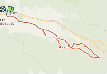

Length
13.6 km

Max alt
379 m

Uphill gradient
188 m
Km-Effort
16.1 km

Min alt
317 m

Downhill gradient
188 m
Boucle
Yes
Creation date :
2024-03-13 09:07:11.172
Updated on :
2024-03-13 19:31:45.517
4h10
Difficulty : Medium

FREE GPS app for hiking
 SityTrail
IGN / Geographical institutes
SityTrail Plus
The world is yours!
About
Trail Walking of 13.6 km to be discovered at Provence-Alpes-Côte d'Azur, Var, Signes. This trail is proposed by CSMSRANDOS.
Description
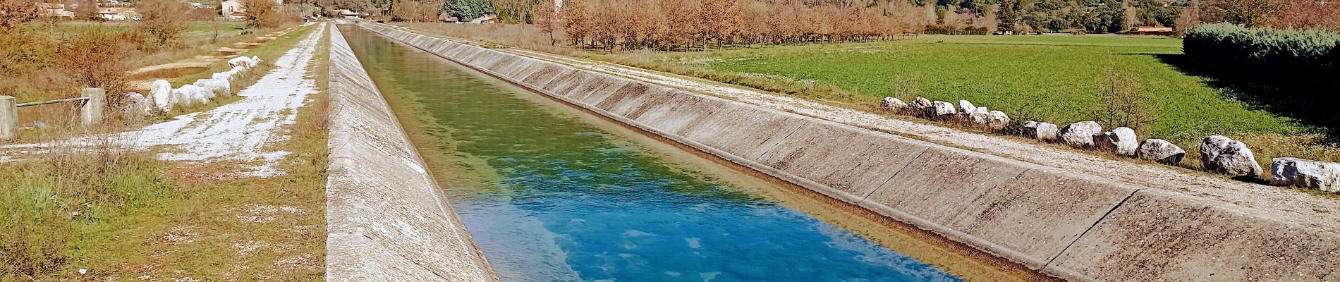
Canal de Provence au départ de Signes le 13 mars 2024
Photos


Positioning
Country:
France
Region :
Provence-Alpes-Côte d'Azur
Department/Province :
Var
Municipality :
Signes
Location:
Unknown
Start:(Dec)
Start:(UTM)
732098 ; 4796944 (31T) N.
Comments