


bussière et Abbans.

dcharbonnier
User
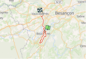

Length
28 km

Max alt
464 m

Uphill gradient
644 m
Km-Effort
37 km

Min alt
225 m

Downhill gradient
676 m
Boucle
No
Creation date :
2024-03-14 08:06:46.178
Updated on :
2024-03-14 15:38:58.326
7h12
Difficulty : Difficult

FREE GPS app for hiking
 SityTrail
IGN / Geographical institutes
SityTrail Plus
The world is yours!
About
Trail Walking of 28 km to be discovered at Bourgogne-Franche-Comté, Doubs, Boussières. This trail is proposed by dcharbonnier.
Positioning
Country:
France
Region :
Bourgogne-Franche-Comté
Department/Province :
Doubs
Municipality :
Boussières
Location:
Unknown
Start:(Dec)
Start:(UTM)
720493 ; 5226888 (31T) N.
Comments