


Cala en Porter – Sant Tomàs

Geert H.
User
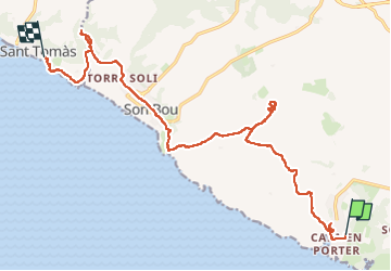


4h42
Difficulty : Very difficult

FREE GPS app for hiking
 SityTrail
IGN / Geographical institutes
SityTrail Plus
The world is yours!
About
Trail Walking of 21 km to be discovered at Balearic Islands, Unknown, Alaior. This trail is proposed by Geert H..
Description
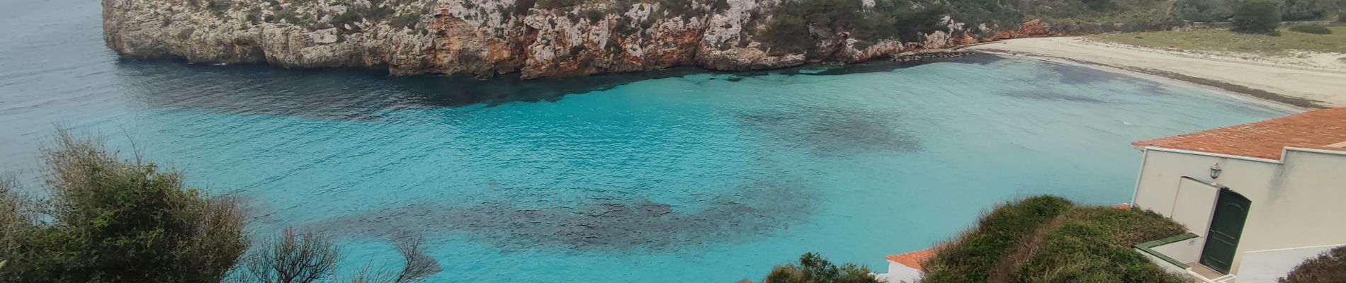
Wandeling vanuit Cala en Porter naar Sant Tomàs. Geleidelijk bergop zichten van de kust afdaling tot aan Son Bou, het langste strand van Menorca. Je gaat door duinlandschappen, boomgaarden en de lagune van Ses Canessiesen tot aan Sant Tomàs. Onderweg is er een kleine omweg naar de archelogische site Torre d'en Galmés.
Photos


36 photos in total. Please click on a photo to see them all in the gallery.
Positioning
Comments