Trail Walking Ciutadella - Cales Piques – Cala Morell - Photo

Cales Piques – Cala Morell

 Geert H.
Geert H.

User

© OpenStreetMap contributors
Length
Length
15.9 km
Max alt
Max alt
107 m
Uphill gradient
Uphill gradient
245 m
Km-Effort
Km-Effort  
19 km
Min alt
Min alt
7 m
Downhill gradient
Downhill gradient
194 m
Boucle
Boucle
No
Creation date :
2024-03-19 08:30:51.747
Updated on :
2024-05-17 11:13:46.093

(0 Reviews)

Walking
Walking
4h01
Difficulty : Very difficult

Scan this QR Code to open this trail in the SityTrail application

FREE GPS app for hiking

Logo SityTrail SityTrail

IGN / Geographical institutes

Download SityTrail from the App Store Download SityTrail from Google Play

Logo SityTrail SityTrail Plus

The world is yours!

Download SityTrail from the App Store Download SityTrail from Google Play Download SityTrail on Huawei AppGallery

About

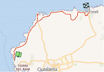
Trail Walking of 15.9 km to be discovered at Balearic Islands, Unknown, Ciutadella. This trail is proposed by Geert H..

Description

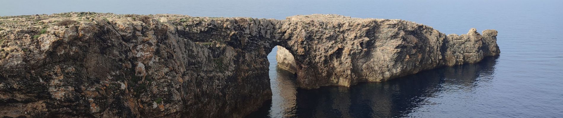
Vanuit Cales Piques, aan deze kant van het eiland tramuntana. Hierdoor vind je hier op heel wat plekken muurtjes om tegen de wind beschut te zijn. Flora is hier erg beperkt, vooral kruiden zoals rozemarijn en kamille groeien hier. Eindpunt is Cala Morell, een populair vakantieoord.

Elevation profile

Photos

24 photos in total. Please click on a photo to see them all in the gallery.

Positioning

Country:
Spain
Region :
Balearic Islands
Department/Province :
Unknown
Municipality :
Ciutadella
Location:
Unknown
Start:(UTM)
567969 ; 4428978 (31T) N.


Close
My subscriptions