


vitrolles sources de l'infernet

ego
User

Length
8.7 km

Max alt
115 m

Uphill gradient
65 m
Km-Effort
9.5 km

Min alt
56 m

Downhill gradient
62 m
Boucle
Yes
Creation date :
2024-03-20 08:38:53.748
Updated on :
2024-03-20 12:04:42.213
2h35
Difficulty : Medium

FREE GPS app for hiking
 SityTrail
IGN / Geographical institutes
SityTrail Plus
The world is yours!
About
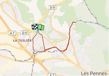
Trail Walking of 8.7 km to be discovered at Provence-Alpes-Côte d'Azur, Bouches-du-Rhône, Vitrolles. This trail is proposed by ego .
Positioning
Country:
France
Region :
Provence-Alpes-Côte d'Azur
Department/Province :
Bouches-du-Rhône
Municipality :
Vitrolles
Location:
Unknown
Start:(Dec)
Start:(UTM)
684242 ; 4810773 (31T) N.
Comments