


Cauterets, cascade de Lutour - 7

hartmannpat
User
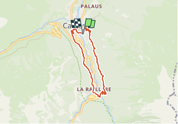

Length
7 km

Max alt
1209 m

Uphill gradient
335 m
Km-Effort
11.4 km

Min alt
932 m

Downhill gradient
332 m
Boucle
Yes
Creation date :
2024-03-21 08:02:02.149
Updated on :
2024-03-23 16:47:51.519
2h35
Difficulty : Medium

FREE GPS app for hiking
 SityTrail
IGN / Geographical institutes
SityTrail Plus
The world is yours!
About
Trail Walking of 7 km to be discovered at Occitania, Hautespyrenees, Cauterets. This trail is proposed by hartmannpat.
Positioning
Country:
France
Region :
Occitania
Department/Province :
Hautespyrenees
Municipality :
Cauterets
Location:
Unknown
Start:(Dec)
Start:(UTM)
735756 ; 4752318 (30T) N.
Comments