Trail Walking Honfleur - 20240328-honfleur A M new - Photo

20240328-honfleur A M new

 doudet
doudet

User

© OpenStreetMap contributors
Length
Length
6.2 km
Max alt
Max alt
22 m
Uphill gradient
Uphill gradient
48 m
Km-Effort
Km-Effort  
6.9 km
Min alt
Min alt
0 m
Downhill gradient
Downhill gradient
48 m
Boucle
Boucle
Yes
Creation date :
2024-03-21 14:37:34.851
Updated on :
2024-03-27 16:40:43.746

(0 Reviews)

Walking
Walking
1h33
Difficulty : Medium

Scan this QR Code to open this trail in the SityTrail application

FREE GPS app for hiking

Logo SityTrail SityTrail

IGN / Geographical institutes

Download SityTrail from the App Store Download SityTrail from Google Play

Logo SityTrail SityTrail World

The world is yours!

Download SityTrail from the App Store Download SityTrail from Google Play Download SityTrail on Huawei AppGallery

About

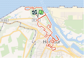
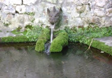
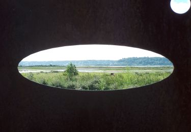
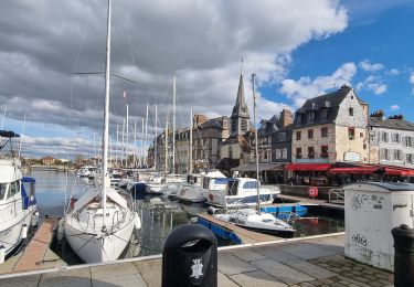
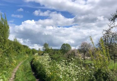
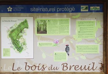
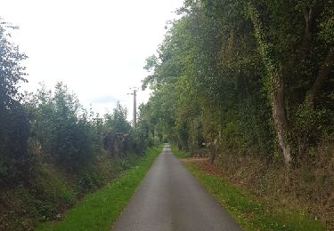
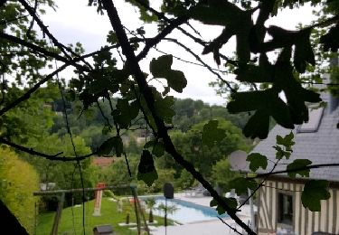
Trail Walking of 6.2 km to be discovered at Normandy, Calvados, Honfleur. This trail is proposed by doudet.

Elevation profile

Photos

Points of interest

Point of interest Honfleur - 1B - Maison Satie - Photo
doudet
Point of interest Honfleur - 3 - le vieux bassin - Photo
doudet
Point of interest Honfleur - 4 - jardin du tripot - Photo
doudet
Point of interest Honfleur - 5 - Eglise St Léonard - Photo
doudet
Point of interest Honfleur - 6 - le grenier a sel - Photo
doudet
Point of interest Honfleur - 8 - musee de la marine - Photo
doudet
Point of interest Honfleur - 10 - la lieutenance - Photo
doudet
Point of interest Honfleur - 11 - le jardin retrouve - Photo
doudet
Point of interest Honfleur - ruelle des 36 marches - Photo
doudet

Positioning

Country:
France
Region :
Normandy
Department/Province :
Calvados
Municipality :
Honfleur
Location:
Unknown
Start:(UTM)
299052 ; 5478457 (31U) N.

Trails nearby

Trail Walking Honfleur - Rando VTT Honfleur - Photo
Walking
tracegps

Walking

Very difficult
(1)
Honfleur, Normandy, Calvados, France
33 km | 41 km-effort
4h 0min
Yes
Trail Walking Équemauville - 076-63 -Honfleur 22km--596-772 - Photo
Walking
rvs147

Walking

Easy
(1)
Équemauville, Normandy, Calvados, France
21 km | 27 km-effort
3h 34min
Yes
Trail Walking Oudalle - Le marais d'Amfard - Photo
Walking
MarcherEnsemble

Walking

Easy
Oudalle, Normandy, Seine-Maritime, France
4.8 km | 5.1 km-effort
1h 42min
No
Trail Walking Honfleur - Honfleur (PVDB) - Photo
Walking
GUIDE
Peter.vdbergh

Walking

Easy
Honfleur, Normandy, Calvados, France
8 km | 9.7 km-effort
2h 19min
No
Trail Walking Barneville-la-Bertran - Honfleur  - Photo
Walking
bernardb2

Walking

Medium
Barneville-la-Bertran, Normandy, Calvados, France
8.1 km | 9.8 km-effort
2h 10min
Yes
Trail Walking Pennedepie - Pennedepie - Photo
Walking
Roulland

Walking

Easy
Pennedepie, Normandy, Calvados, France
21 km | 24 km-effort
4h 35min
Yes
Trail Walking Honfleur - CRAB : Du côté de Honfleur - Photo
Walking
PatRando

Walking

Medium
Honfleur, Normandy, Calvados, France
19.3 km | 23 km-effort
4h 6min
Yes
Trail Walking Honfleur - Honfleur - Honfleur par gonneville sur honfleir - Photo
Walking
Roulland

Walking

Easy
Honfleur, Normandy, Calvados, France
12.5 km | 14.8 km-effort
2h 35min
Yes
Trail Walking Pennedepie - 2012-05-29 13h35m05 - Photo
Walking
Jeff_314

Walking

Easy
(1)
Pennedepie, Normandy, Calvados, France
6.6 km | 8.2 km-effort
2h 10min
Yes


Close
My subscriptions