


no

explorateur
User
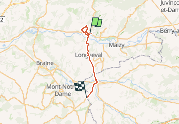

Length
24 km

Max alt
172 m

Uphill gradient
390 m
Km-Effort
28 km

Min alt
43 m

Downhill gradient
299 m
Boucle
No
Creation date :
2024-03-21 13:11:41.216
Updated on :
2024-03-21 15:54:20.875
2h41
Difficulty : Very difficult

FREE GPS app for hiking
 SityTrail
IGN / Geographical institutes
SityTrail Plus
The world is yours!
About
Trail Walking of 24 km to be discovered at Hauts-de-France, Aisne, Bourg-et-Comin. This trail is proposed by explorateur.
Positioning
Country:
France
Region :
Hauts-de-France
Department/Province :
Aisne
Municipality :
Bourg-et-Comin
Location:
Unknown
Start:(Dec)
Start:(UTM)
547860 ; 5471873 (31U) N.
Comments