


st Medard

TOULAUDIN
User
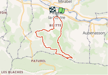

Length
15.2 km

Max alt
833 m

Uphill gradient
775 m
Km-Effort
26 km

Min alt
231 m

Downhill gradient
776 m
Boucle
Yes
Creation date :
2024-03-22 08:12:02.663
Updated on :
2024-03-22 15:34:58.647
6h17
Difficulty : Difficult

FREE GPS app for hiking
 SityTrail
IGN / Geographical institutes
SityTrail Plus
The world is yours!
About
Trail Walking of 15.2 km to be discovered at Auvergne-Rhône-Alpes, Drôme, Piégros-la-Clastre. This trail is proposed by TOULAUDIN.
Positioning
Country:
France
Region :
Auvergne-Rhône-Alpes
Department/Province :
Drôme
Municipality :
Piégros-la-Clastre
Location:
Unknown
Start:(Dec)
Start:(UTM)
666235 ; 4951576 (31T) N.
Comments