


Les Reīs Castelmourié

supercolas
User GUIDE
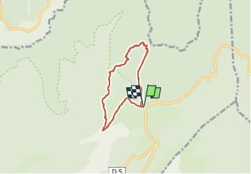

Length
5.4 km

Max alt
710 m

Uphill gradient
222 m
Km-Effort
8.3 km

Min alt
584 m

Downhill gradient
222 m
Boucle
Yes
Creation date :
2024-03-22 11:54:07.586
Updated on :
2024-03-22 18:26:27.458
1h35
Difficulty : Easy

FREE GPS app for hiking
 SityTrail
IGN / Geographical institutes
SityTrail Plus
The world is yours!
About
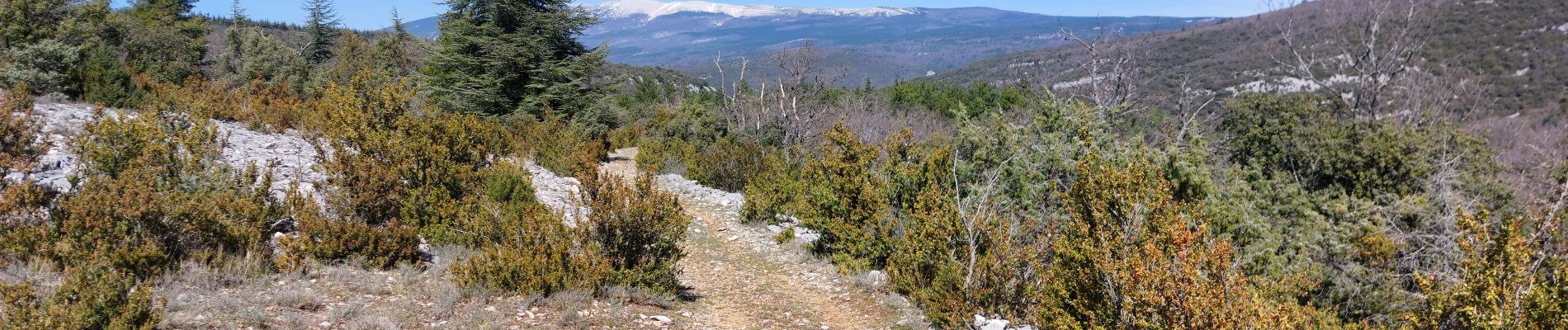
Trail Walking of 5.4 km to be discovered at Provence-Alpes-Côte d'Azur, Vaucluse, Méthamis. This trail is proposed by supercolas.
Description
Methamis
Photos


Positioning
Country:
France
Region :
Provence-Alpes-Côte d'Azur
Department/Province :
Vaucluse
Municipality :
Méthamis
Location:
Unknown
Start:(Dec)
Start:(UTM)
683635 ; 4876795 (31T) N.
Comments