Trail Walking Callas - Callas - Le Pont d'Endre depuis Les Crottes  - Photo

Callas - Le Pont d'Endre depuis Les Crottes

© OpenStreetMap contributors
Length
Length
9.6 km
Max alt
Max alt
292 m
Uphill gradient
Uphill gradient
232 m
Km-Effort
Km-Effort  
12.7 km
Min alt
Min alt
128 m
Downhill gradient
Downhill gradient
233 m
Boucle
Boucle
Yes
Creation date :
2024-03-24 17:13:48.543
Updated on :
2024-04-01 20:51:17.436

(0 Reviews)

Walking
Walking
2h52
Difficulty : Difficult

Scan this QR Code to open this trail in the SityTrail application

FREE GPS app for hiking

Logo SityTrail SityTrail

IGN / Geographical institutes

Download SityTrail from the App Store Download SityTrail from Google Play

Logo SityTrail SityTrail World

The world is yours!

Download SityTrail from the App Store Download SityTrail from Google Play Download SityTrail on Huawei AppGallery

About

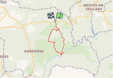
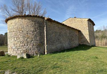
Trail Walking of 9.6 km to be discovered at Provence-Alpes-Côte d'Azur, Var, Callas. This trail is proposed by domgaudillere.

Description

Randonnée en boucle depuis la route départementale 562, 3 km après le carrefour des 4 chemins en direction de Grasse. Départ au point GPS 43.5764,6.5979
Parking sur le départ de la piste (citerne)
Descendre sur la piste de Colle Rousse dite aussi Les Crottes.
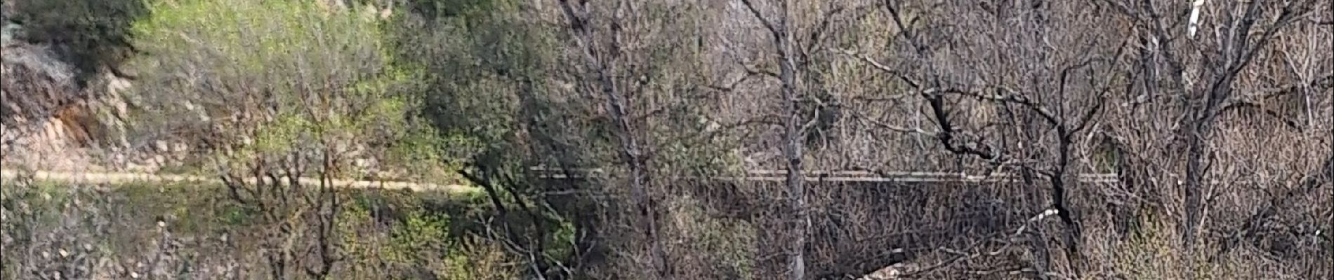
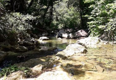
700 m après partir à gauche sur une piste qui descend en lacets  sur 400 m pour rejoindre le vallon de la Joyeuse, le traverser et rejoindre par un petit sentier étroit le vallon de Vioune (Km 1,7)
Suivre la Vioune, au Km 3,3 la traverser et partir en montant sur la droite, un chemin confortable qui descend ensuite vers la piste de la Mine (Km 4,5)
Descendre sur 1Km100 pour aller jusqu'au Pont d'Endre
Puis remonter en prenant à droite à la bifurcation, on laisse la piste de la Mine sur la gauche (Km 5)
On est sur la piste de Colle Rousse qui nous remonte au parking  sur 150m de dénivelé et 4,5 Km.

Elevation profile

Photos

Positioning

Country:
France
Region :
Provence-Alpes-Côte d'Azur
Department/Province :
Var
Municipality :
Callas
Location:
Unknown
Start:(Dec)
Start:(UTM)
306080 ; 4827582 (32T) N.

Trails nearby

Trail Walking Callas - gorge de Penafore - Photo
Walking
marmotte83

Walking

Very easy
(1)
Callas, Provence-Alpes-Côte d'Azur, Var, France
1.1 km | 1.3 km-effort
1h 33min
Yes
Trail Walking Callas - Callas- Autour de la Chapelle Saint-Auxile - Photo
Walking
Chantheys

Walking

Medium
Callas, Provence-Alpes-Côte d'Azur, Var, France
6.4 km | 9.5 km-effort
2h 9min
Yes
Trail Walking Callas - Callas fait  - Photo
Walking
ETMU5496

Walking

Medium
Callas, Provence-Alpes-Côte d'Azur, Var, France
20 km | 31 km-effort
6h 55min
Yes
Trail Walking Callas - La catalane ,Font Blanche, les Cabanons - Photo
Walking
boulinevelyne

Walking

Medium
(1)
Callas, Provence-Alpes-Côte d'Azur, Var, France
10.3 km | 14.2 km-effort
3h 19min
Yes
Trail Walking Claviers - Claviers - St Arnoux - Photo
Walking
ETMU5496

Walking

Medium
Claviers, Provence-Alpes-Côte d'Azur, Var, France
18 km | 26 km-effort
4h 2min
Yes
Trail Walking Seillans - La Pigne - Photo
Walking
avdem

Walking

Easy
Seillans, Provence-Alpes-Côte d'Azur, Var, France
16.3 km | 23 km-effort
5h 51min
Yes
Trail Walking Bargemon - Bargemon - ND - Ste Anne de Claviers - Chapelle St Arnoux - Photo
Walking
LtZIP

Walking

Easy
Bargemon, Provence-Alpes-Côte d'Azur, Var, France
19.9 km | 29 km-effort
4h 29min
Yes
Trail Walking Seillans - Le lac de Meaulx - Photo
Walking
boulinevelyne

Walking

Medium
Seillans, Provence-Alpes-Côte d'Azur, Var, France
10.8 km | 13.7 km-effort
2h 26min
Yes
Trail Walking Saint-Paul-en-Forêt - SityTrail - LAC DE MEAULT ?VERSION 15 KMS 340 M - Photo
Walking
LtZIP

Walking

Medium
(1)
Saint-Paul-en-Forêt, Provence-Alpes-Côte d'Azur, Var, France
14.8 km | 19.3 km-effort
4h 7min
Yes


Close
My subscriptions