


chapelle marguerite combovin

brigitBB26
User
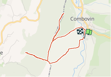

Length
5.2 km

Max alt
530 m

Uphill gradient
208 m
Km-Effort
7.9 km

Min alt
359 m

Downhill gradient
207 m
Boucle
Yes
Creation date :
2024-03-25 12:37:27.171
Updated on :
2024-03-25 15:21:09.748
2h43
Difficulty : Medium

FREE GPS app for hiking
 SityTrail
IGN / Geographical institutes
SityTrail Plus
The world is yours!
About
Trail Walking of 5.2 km to be discovered at Auvergne-Rhône-Alpes, Drôme, Combovin. This trail is proposed by brigitBB26.
Positioning
Country:
France
Region :
Auvergne-Rhône-Alpes
Department/Province :
Drôme
Municipality :
Combovin
Location:
Unknown
Start:(Dec)
Start:(UTM)
664088 ; 4970762 (31T) N.
Comments