


Avalon-Pontcharra

René Vacher
User
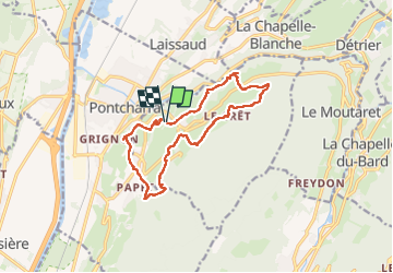

Length
13.5 km

Max alt
620 m

Uphill gradient
663 m
Km-Effort
22 km

Min alt
301 m

Downhill gradient
656 m
Boucle
Yes
Creation date :
2024-03-26 08:28:11.582
Updated on :
2024-03-26 16:54:00.03
5h28
Difficulty : Very difficult

FREE GPS app for hiking
 SityTrail
IGN / Geographical institutes
SityTrail Plus
The world is yours!
About
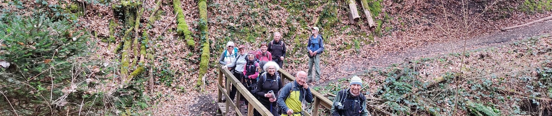
Trail Walking of 13.5 km to be discovered at Auvergne-Rhône-Alpes, Isère, Saint-Maximin. This trail is proposed by René Vacher.
Photos


Positioning
Country:
France
Region :
Auvergne-Rhône-Alpes
Department/Province :
Isère
Municipality :
Saint-Maximin
Location:
Unknown
Start:(Dec)
Start:(UTM)
267970 ; 5034958 (32T) N.
Comments