


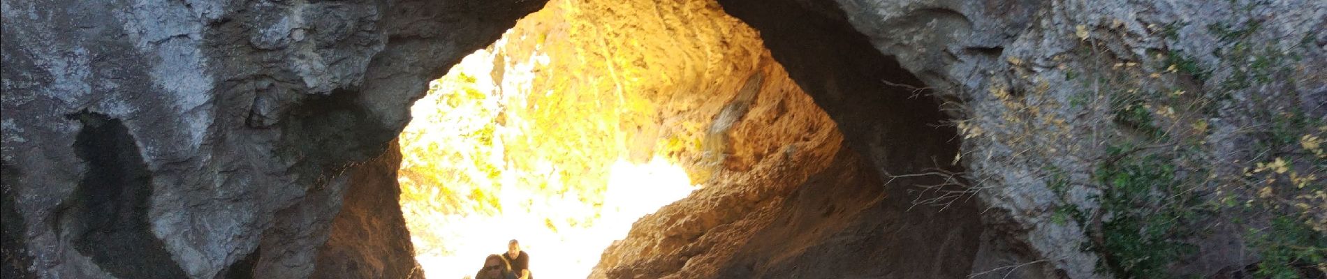
Échelles StRemy de Provence

cousam
User
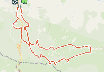

Length
15 km

Max alt
389 m

Uphill gradient
556 m
Km-Effort
22 km

Min alt
103 m

Downhill gradient
559 m
Boucle
Yes
Creation date :
2024-03-28 08:30:24.511
Updated on :
2024-03-29 06:55:07.256
6h28
Difficulty : Difficult

FREE GPS app for hiking
 SityTrail
IGN / Geographical institutes
SityTrail Plus
The world is yours!
About
Trail Walking of 15 km to be discovered at Provence-Alpes-Côte d'Azur, Bouches-du-Rhône, Saint-Rémy-de-Provence. This trail is proposed by cousam.
Photos


34 photos in total. Please click on a photo to see them all in the gallery.
Positioning
Country:
France
Region :
Provence-Alpes-Côte d'Azur
Department/Province :
Bouches-du-Rhône
Municipality :
Saint-Rémy-de-Provence
Location:
Unknown
Start:(Dec)
Start:(UTM)
647521 ; 4848743 (31T) N.
Comments