


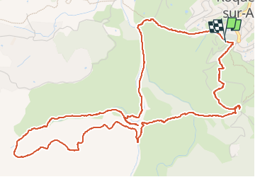
Randonnée des 25 Ponts - Roquebrune / Argens

GeorgesV.
User

Length
8.2 km

Max alt
141 m

Uphill gradient
225 m
Km-Effort
11.3 km

Min alt
18 m

Downhill gradient
226 m
Boucle
Yes
Creation date :
2024-03-29 07:44:33.0
Updated on :
2024-03-29 11:13:20.69

FREE GPS app for hiking
 SityTrail
IGN / Geographical institutes
SityTrail Plus
The world is yours!
About
Trail of 8.2 km to be discovered at Provence-Alpes-Côte d'Azur, Var, Roquebrune-sur-Argens. This trail is proposed by GeorgesV..
Positioning
Country:
France
Region :
Provence-Alpes-Côte d'Azur
Department/Province :
Var
Municipality :
Roquebrune-sur-Argens
Location:
Unknown
Start:(Dec)
Start:(UTM)
308412 ; 4812425 (32T) N.
Comments