


2024-03-30_13h57m18_ifrane-col-montagneux-de-michlifen

jpb83
User
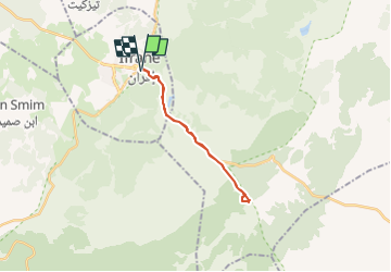

Length
23 km

Max alt
2005 m

Uphill gradient
452 m
Km-Effort
29 km

Min alt
1646 m

Downhill gradient
449 m
Boucle
Yes
Creation date :
2024-03-30 12:57:18.184
Updated on :
2024-04-01 10:53:39.835
6h30
Difficulty : Medium
3h00
Difficulty : Difficult

FREE GPS app for hiking
 SityTrail
IGN / Geographical institutes
SityTrail Plus
The world is yours!
About
Trail Walking of 23 km to be discovered at Fez-Meknes, Pachalik d'Ifrane ⵜⴰⴱⴰⵛⴰⵏⵜ ⵏ ⵉⴼⵔⴰⵏ باشوية إفران, Ifrane. This trail is proposed by jpb83.
Positioning
Country:
Morocco
Region :
Fez-Meknes
Department/Province :
Pachalik d'Ifrane ⵜⴰⴱⴰⵛⴰⵏⵜ ⵏ ⵉⴼⵔⴰⵏ باشوية إفران
Municipality :
Ifrane
Location:
Unknown
Start:(Dec)
Start:(UTM)
304436 ; 3711547 (30S) N.
Comments