


M'ont Daisen Japon

Lauvalarnoult
User
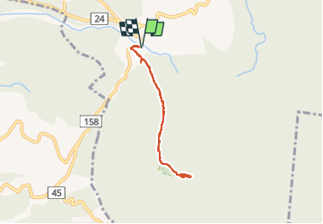

Length
7.2 km

Max alt
1698 m

Uphill gradient
921 m
Km-Effort
19.5 km

Min alt
770 m

Downhill gradient
924 m
Boucle
Yes
Creation date :
2024-03-31 00:11:50.008
Updated on :
2024-03-31 03:58:21.002
3h46
Difficulty : Very difficult

FREE GPS app for hiking
 SityTrail
IGN / Geographical institutes
SityTrail World
The world is yours!
About
Trail Walking of 7.2 km to be discovered at Tottori Prefecture, Saihaku County, Unknown. This trail is proposed by Lauvalarnoult.
Positioning
Country:
Japan
Region :
Tottori Prefecture
Department/Province :
Saihaku County
Municipality :
Unknown
Location:
旧大山町
Start:(Dec)
Start:(UTM)
366584 ; 3917386 (53S) N.
Comments
Trails nearby