


CHADOUILLET

asclier0
User
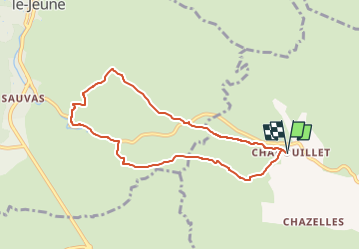

Length
7.8 km

Max alt
252 m

Uphill gradient
118 m
Km-Effort
9.4 km

Min alt
165 m

Downhill gradient
118 m
Boucle
Yes
Creation date :
2024-04-01 10:06:17.452
Updated on :
2024-04-01 15:37:21.548
2h08
Difficulty : Medium
39m
Difficulty : Easy

FREE GPS app for hiking
 SityTrail
IGN / Geographical institutes
SityTrail Plus
The world is yours!
About
Trail Walking of 7.8 km to be discovered at Auvergne-Rhône-Alpes, Ardèche, Saint-André-de-Cruzières. This trail is proposed by asclier0.
Description
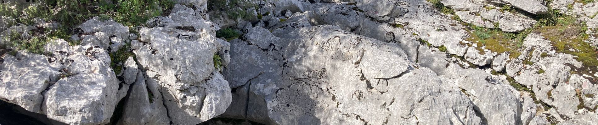
Boucle garrigue et dolmen.
Détour pour voir la résurgence, vaut le coup après de fortes pluies.
Photos


Positioning
Country:
France
Region :
Auvergne-Rhône-Alpes
Department/Province :
Ardèche
Municipality :
Saint-André-de-Cruzières
Location:
Unknown
Start:(Dec)
Start:(UTM)
595409 ; 4908123 (31T) N.
Comments