


Château de Villette

Fky78
User

Length
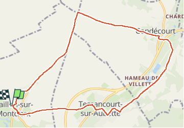
11.2 km

Max alt
124 m

Uphill gradient
178 m
Km-Effort
13.5 km

Min alt
33 m

Downhill gradient
176 m
Boucle
Yes
Creation date :
2024-04-01 10:25:33.64
Updated on :
2024-04-01 13:32:38.261
2h44
Difficulty : Medium

FREE GPS app for hiking
 SityTrail
IGN / Geographical institutes
SityTrail Plus
The world is yours!
About
Trail Walking of 11.2 km to be discovered at Ile-de-France, Yvelines, Gaillon-sur-Montcient. This trail is proposed by Fky78.
Positioning
Country:
France
Region :
Ile-de-France
Department/Province :
Yvelines
Municipality :
Gaillon-sur-Montcient
Location:
Unknown
Start:(Dec)
Start:(UTM)
418991 ; 5430860 (31U) N.
Comments