


Poujan, l Archette,le Jas

tyntyn
User
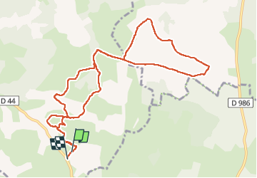

Length
12.3 km

Max alt
968 m

Uphill gradient
151 m
Km-Effort
14.3 km

Min alt
886 m

Downhill gradient
153 m
Boucle
Yes
Creation date :
2024-04-01 12:19:26.714
Updated on :
2024-04-01 15:26:15.726
2h30
Difficulty : Easy

FREE GPS app for hiking
 SityTrail
IGN / Geographical institutes
SityTrail Plus
The world is yours!
About
Trail Walking of 12.3 km to be discovered at Occitania, Lozère, Chanac. This trail is proposed by tyntyn.
Positioning
Country:
France
Region :
Occitania
Department/Province :
Lozère
Municipality :
Chanac
Location:
Chanac
Start:(Dec)
Start:(UTM)
532397 ; 4918984 (31T) N.
Comments