Trail Walking Prévenchères -  Gorges de Chassezac - Photo

Gorges de Chassezac

 cousam
cousam

User

© OpenStreetMap contributors
Length
Length
19 km
Max alt
Max alt
895 m
Uphill gradient
Uphill gradient
807 m
Km-Effort
Km-Effort  
30 km
Min alt
Min alt
369 m
Downhill gradient
Downhill gradient
813 m
Boucle
Boucle
Yes
Creation date :
2024-04-01 07:53:13.687
Updated on :
2024-04-01 20:09:03.298

(0 Reviews)

Walking
Walking
7h33
Difficulty : Difficult

Scan this QR Code to open this trail in the SityTrail application

FREE GPS app for hiking

Logo SityTrail SityTrail

IGN / Geographical institutes

Download SityTrail from the App Store Download SityTrail from Google Play

Logo SityTrail SityTrail Plus

The world is yours!

Download SityTrail from the App Store Download SityTrail from Google Play Download SityTrail on Huawei AppGallery

About

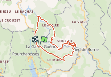
Trail Walking of 19 km to be discovered at Occitania, Lozère, Prévenchères. This trail is proposed by cousam.

Description

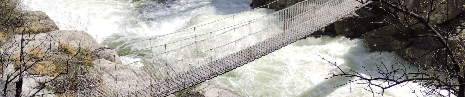
Rando effectuée après de grosses pluies tombées la veille (160mm).
Impossible de passer les gués au km 6 fait 1/2 tour et au Km 14 de redescendre le sentier direct pour la Garde Guérin, car le gué était inaccessible.
Par contre super le torrent Chassezac gonflé par cette crue.

Elevation profile

Photos

36 photos in total. Please click on a photo to see them all in the gallery.

Positioning

Country:
France
Region :
Occitania
Department/Province :
Lozère
Municipality :
Prévenchères
Location:
Unknown
Start:(UTM)
574267 ; 4925369 (31T) N.


Close
My subscriptions