


montaigut

lablaquiere
User
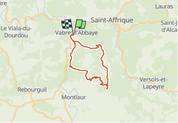

Length
25 km

Max alt
698 m

Uphill gradient
614 m
Km-Effort
33 km

Min alt
308 m

Downhill gradient
613 m
Boucle
Yes
Creation date :
2024-04-01 13:44:03.984
Updated on :
2024-04-01 16:52:55.995
2h03
Difficulty : Difficult

FREE GPS app for hiking
 SityTrail
IGN / Geographical institutes
SityTrail Plus
The world is yours!
About
Trail Mountain bike of 25 km to be discovered at Occitania, Aveyron, Vabres-l'Abbaye. This trail is proposed by lablaquiere.
Positioning
Country:
France
Region :
Occitania
Department/Province :
Aveyron
Municipality :
Vabres-l'Abbaye
Location:
Unknown
Start:(Dec)
Start:(UTM)
486706 ; 4865446 (31T) N.
Comments