


Charbillat

Jackoyo
User
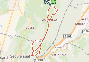

Length
9.1 km

Max alt
727 m

Uphill gradient
307 m
Km-Effort
13.2 km

Min alt
593 m

Downhill gradient
315 m
Boucle
Yes
Creation date :
2024-04-02 11:46:38.335
Updated on :
2024-04-02 14:09:27.849
2h21
Difficulty : Very easy

FREE GPS app for hiking
 SityTrail
IGN / Geographical institutes
SityTrail Plus
The world is yours!
About
Trail Walking of 9.1 km to be discovered at Auvergne-Rhône-Alpes, Ain, Izernore. This trail is proposed by Jackoyo .
Positioning
Country:
France
Region :
Auvergne-Rhône-Alpes
Department/Province :
Ain
Municipality :
Izernore
Location:
Unknown
Start:(Dec)
Start:(UTM)
698749 ; 5120919 (31T) N.
Comments