


lp80_eaucourt

GR77LP
User
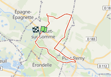

Length
7.2 km

Max alt
105 m

Uphill gradient
127 m
Km-Effort
8.9 km

Min alt
3 m

Downhill gradient
127 m
Boucle
Yes
Creation date :
2024-03-26 12:57:43.042
Updated on :
2024-04-04 07:50:57.386
2h01
Difficulty : Medium

FREE GPS app for hiking
 SityTrail
IGN / Geographical institutes
SityTrail Plus
The world is yours!
About
Trail Walking of 7.2 km to be discovered at Hauts-de-France, Somme, Eaucourt-sur-Somme. This trail is proposed by GR77LP.
Description
Parking : salle des fêtes Eaucourt-sur-Somme
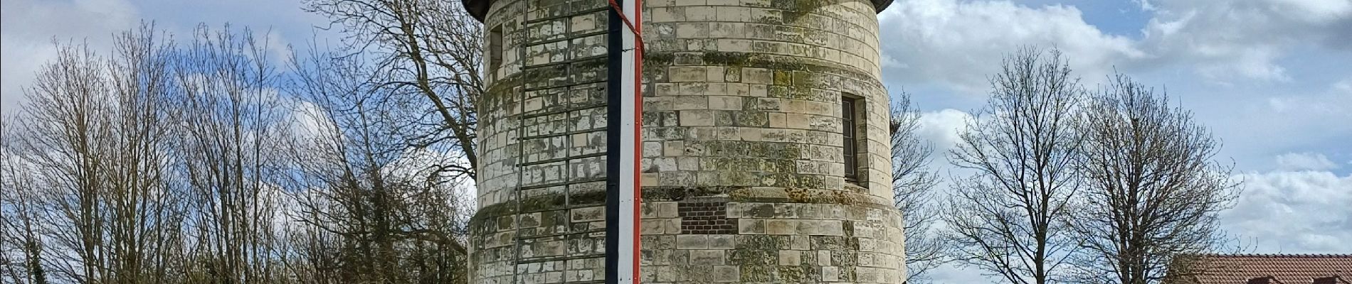
Passage par le Moulin d'Eaucourt et le château
Photos


Positioning
Country:
France
Region :
Hauts-de-France
Department/Province :
Somme
Municipality :
Eaucourt-sur-Somme
Location:
Unknown
Start:(Dec)
Start:(UTM)
420062 ; 5546310 (31U) N.
Comments