


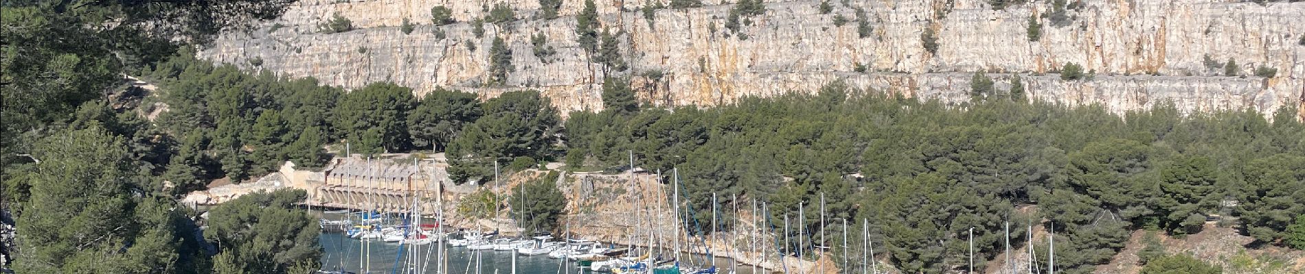
Les 3 calanques

michelpaulin
User
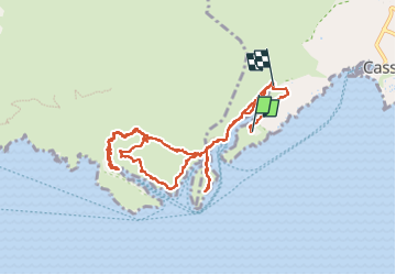

Length
12.5 km

Max alt
149 m

Uphill gradient
443 m
Km-Effort
18.4 km

Min alt
3 m

Downhill gradient
446 m
Boucle
No
Creation date :
2024-04-02 07:54:38.0
Updated on :
2024-04-03 08:23:44.413
4h10
Difficulty : Difficult

FREE GPS app for hiking
 SityTrail
IGN / Geographical institutes
SityTrail Plus
The world is yours!
About
Trail Walking of 12.5 km to be discovered at Provence-Alpes-Côte d'Azur, Bouches-du-Rhône, Cassis. This trail is proposed by michelpaulin.
Description
TRES BELLE RANDONNEE SUPERBES VUES MAIS AVEC DES PASSAGES DELICATS PIERRES GLISSANTES ET EBOULIS
Photos


Positioning
Country:
France
Region :
Provence-Alpes-Côte d'Azur
Department/Province :
Bouches-du-Rhône
Municipality :
Cassis
Location:
Unknown
Start:(Dec)
Start:(UTM)
704623 ; 4786848 (31T) N.
Comments