


Roeux 13.5

temjacques
User
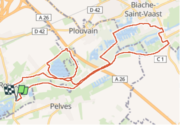

Length
13.5 km

Max alt
65 m

Uphill gradient
67 m
Km-Effort
14.4 km

Min alt
42 m

Downhill gradient
66 m
Boucle
Yes
Creation date :
2024-04-02 12:15:20.507
Updated on :
2024-04-02 15:14:07.008
2h58
Difficulty : Difficult

FREE GPS app for hiking
 SityTrail
IGN / Geographical institutes
SityTrail Plus
The world is yours!
About
Trail Walking of 13.5 km to be discovered at Hauts-de-France, Pas-de-Calais, Rœux. This trail is proposed by temjacques.
Description
Lac bleu Scarpe Marais
Positioning
Country:
France
Region :
Hauts-de-France
Department/Province :
Pas-de-Calais
Municipality :
Rœux
Location:
Unknown
Start:(Dec)
Start:(UTM)
492906 ; 5571031 (31U) N.
Comments