


L'Aubanède

ARPF
User
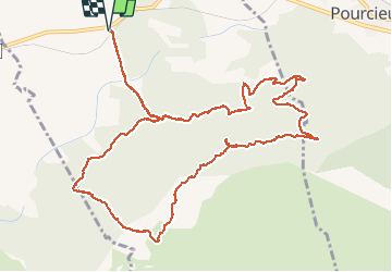

Length
15.3 km

Max alt
651 m

Uphill gradient
484 m
Km-Effort
22 km

Min alt
299 m

Downhill gradient
483 m
Boucle
Yes
Creation date :
2015-03-27 00:00:00.0
Updated on :
2015-03-27 00:00:00.0
4h41
Difficulty : Medium

FREE GPS app for hiking
 SityTrail
IGN / Geographical institutes
SityTrail Plus
The world is yours!
About
Trail Walking of 15.3 km to be discovered at Provence-Alpes-Côte d'Azur, Var, Pourrières. This trail is proposed by ARPF.
Description
P2- T2- Très beau vallon avec beaucoup d'eau le jour ou nous l'avons fait. 26/03/2015 Philippe
Positioning
Country:
France
Region :
Provence-Alpes-Côte d'Azur
Department/Province :
Var
Municipality :
Pourrières
Location:
Unknown
Start:(Dec)
Start:(UTM)
722060 ; 4816367 (31T) N.
Comments