


Nouveau guide Hobokense Polder

hedwigedw
User

Length
6.3 km

Max alt
10 m

Uphill gradient
32 m
Km-Effort
6.7 km

Min alt
-3 m

Downhill gradient
32 m
Boucle
Yes
Creation date :
2015-03-26 00:00:00.0
Updated on :
2015-03-26 00:00:00.0
4h00
Difficulty : Unknown

FREE GPS app for hiking
 SityTrail
IGN / Geographical institutes
SityTrail Plus
The world is yours!
About
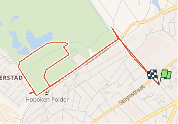
Trail Other activity of 6.3 km to be discovered at Flanders, Antwerp, Antwerp. This trail is proposed by hedwigedw.
Description
Tocht naar Hobokense Polder
Positioning
Country:
Belgium
Region :
Flanders
Department/Province :
Antwerp
Municipality :
Antwerp
Location:
Hoboken
Start:(Dec)
Start:(UTM)
595658 ; 5671186 (31U) N.
Comments