


g1 silhac réel

bernardchasson
User

Length
19.7 km

Max alt
730 m

Uphill gradient
517 m
Km-Effort
27 km

Min alt
467 m

Downhill gradient
503 m
Boucle
No
Creation date :
2024-04-04 07:00:53.811
Updated on :
2024-04-04 13:38:47.151
5h00
Difficulty : Medium

FREE GPS app for hiking
 SityTrail
IGN / Geographical institutes
SityTrail Plus
The world is yours!
About
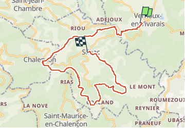
Trail Walking of 19.7 km to be discovered at Auvergne-Rhône-Alpes, Ardèche, Vernoux-en-Vivarais. This trail is proposed by bernardchasson.
Description
facile mais un peu trop de goudrons.
Positioning
Country:
France
Region :
Auvergne-Rhône-Alpes
Department/Province :
Ardèche
Municipality :
Vernoux-en-Vivarais
Location:
Unknown
Start:(Dec)
Start:(UTM)
629514 ; 4972578 (31T) N.
Comments