


sauvignargue jacky

tobia
User
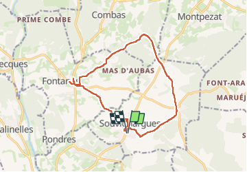

Length
14.9 km

Max alt
139 m

Uphill gradient
193 m
Km-Effort
17.5 km

Min alt
47 m

Downhill gradient
193 m
Boucle
Yes
Creation date :
2024-04-04 12:08:25.402
Updated on :
2024-04-04 16:07:12.295
3h57
Difficulty : Difficult

FREE GPS app for hiking
 SityTrail
IGN / Geographical institutes
SityTrail Plus
The world is yours!
About
Trail Walking of 14.9 km to be discovered at Occitania, Gard, Souvignargues. This trail is proposed by tobia.
Positioning
Country:
France
Region :
Occitania
Department/Province :
Gard
Municipality :
Souvignargues
Location:
Unknown
Start:(Dec)
Start:(UTM)
590223 ; 4851518 (31T) N.
Comments