


LHEZG42021

LouisROGER
User GUIDE
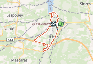

Length
7.9 km

Max alt
354 m

Uphill gradient
139 m
Km-Effort
9.7 km

Min alt
271 m

Downhill gradient
140 m
Boucle
Yes
Creation date :
2024-04-05 07:29:17.326
Updated on :
2024-04-05 13:43:12.645
5h22
Difficulty : Medium

FREE GPS app for hiking
 SityTrail
IGN / Geographical institutes
SityTrail Plus
The world is yours!
About
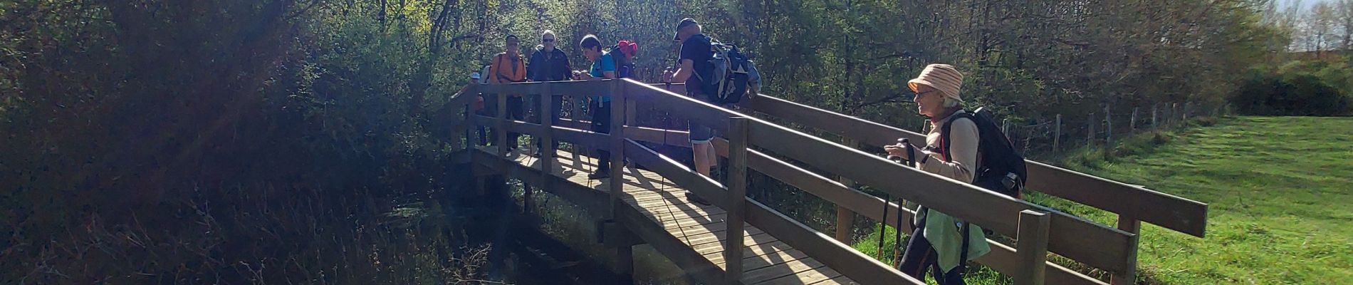
Trail Walking of 7.9 km to be discovered at Occitania, Hautespyrenees, Lhez. This trail is proposed by LouisROGER.
Photos

Positioning
Country:
France
Region :
Occitania
Department/Province :
Hautespyrenees
Municipality :
Lhez
Location:
Unknown
Start:(Dec)
Start:(UTM)
272311 ; 4787334 (31T) N.
Comments