


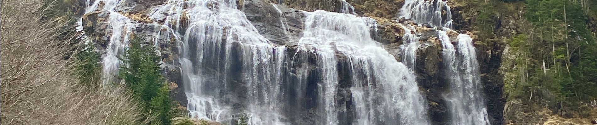
Cascade de l’Ars

lebarça
User
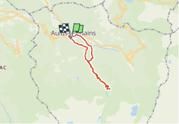

Length
11.8 km

Max alt
1459 m

Uphill gradient
728 m
Km-Effort
22 km

Min alt
747 m

Downhill gradient
731 m
Boucle
Yes
Creation date :
2024-04-07 07:46:11.0
Updated on :
2024-04-07 17:15:42.062
4h53
Difficulty : Easy

FREE GPS app for hiking
 SityTrail
IGN / Geographical institutes
SityTrail Plus
The world is yours!
About
Trail Walking of 11.8 km to be discovered at Occitania, Ariège, Aulus-les-Bains. This trail is proposed by lebarça.
Photos

Positioning
Country:
France
Region :
Occitania
Department/Province :
Ariège
Municipality :
Aulus-les-Bains
Location:
Unknown
Start:(Dec)
Start:(UTM)
364072 ; 4738560 (31T) N.
Comments