


La mahaudiere

sameja
User
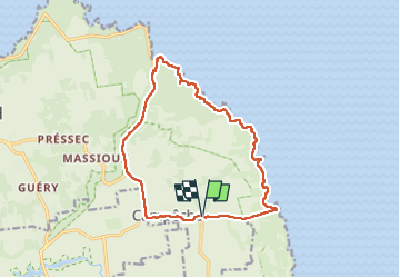

Length
19.8 km

Max alt
58 m

Uphill gradient
240 m
Km-Effort
23 km

Min alt
0 m

Downhill gradient
239 m
Boucle
Yes
Creation date :
2024-04-07 10:22:54.0
Updated on :
2024-04-07 14:01:01.641
3h15
Difficulty : Medium

FREE GPS app for hiking
 SityTrail
IGN / Geographical institutes
SityTrail Plus
The world is yours!
About
Trail Trail of 19.8 km to be discovered at Guadeloupe, Unknown, Anse-Bertrand. This trail is proposed by sameja.
Description
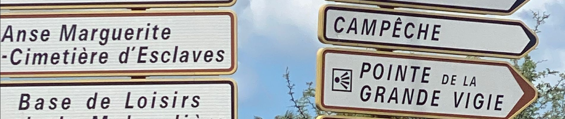
Porte d’enfer la boucle
Photos


Positioning
Country:
France
Region :
Guadeloupe
Department/Province :
Unknown
Municipality :
Anse-Bertrand
Location:
Unknown
Start:(Dec)
Start:(UTM)
667951 ; 1818621 (20Q) N.
Comments