


Jeune5

pourrier
User
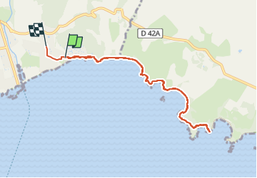

Length
9.9 km

Max alt
28 m

Uphill gradient
116 m
Km-Effort
11.5 km

Min alt
0 m

Downhill gradient
117 m
Boucle
No
Creation date :
2024-04-11 09:06:20.0
Updated on :
2024-04-11 13:03:53.813
3h56
Difficulty : Medium

FREE GPS app for hiking
 SityTrail
IGN / Geographical institutes
SityTrail Plus
The world is yours!
About
Trail Walking of 9.9 km to be discovered at Provence-Alpes-Côte d'Azur, Var, La Londe-les-Maures. This trail is proposed by pourrier.
Positioning
Country:
France
Region :
Provence-Alpes-Côte d'Azur
Department/Province :
Var
Municipality :
La Londe-les-Maures
Location:
Unknown
Start:(Dec)
Start:(UTM)
277039 ; 4777938 (32T) N.
Comments