


Lyon Chemin de Fontanieres-Poncelet
LYON Capitale des Gaules
Ballades urbaines dans LYON
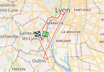

Length
13.5 km

Max alt
303 m

Uphill gradient
245 m
Km-Effort
16.8 km

Min alt
162 m

Downhill gradient
242 m
Boucle
Yes
Creation date :
2024-04-13 06:38:41.0
Updated on :
2024-04-15 18:35:59.465
3h48
Difficulty : Difficult

FREE GPS app for hiking
 SityTrail
IGN / Geographical institutes
SityTrail Plus
The world is yours!
About
Trail Walking of 13.5 km to be discovered at Auvergne-Rhône-Alpes, Métropole de Lyon, Sainte-Foy-lès-Lyon. This trail is proposed by LYON Capitale des Gaules.
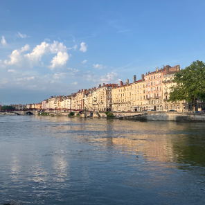
Photos

Positioning
Country:
France
Region :
Auvergne-Rhône-Alpes
Department/Province :
Métropole de Lyon
Municipality :
Sainte-Foy-lès-Lyon
Location:
Unknown
Start:(Dec)
Start:(UTM)
640595 ; 5065868 (31T) N.
Comments