


verdon

Danielba
User GUIDE
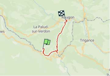

Length
17 km

Max alt
905 m

Uphill gradient
1279 m
Km-Effort
34 km

Min alt
556 m

Downhill gradient
1393 m
Boucle
No
Creation date :
2024-03-24 08:01:12.508
Updated on :
2024-04-13 16:44:19.996
8h56
Difficulty : Very difficult

FREE GPS app for hiking
 SityTrail
IGN / Geographical institutes
SityTrail Plus
The world is yours!
About
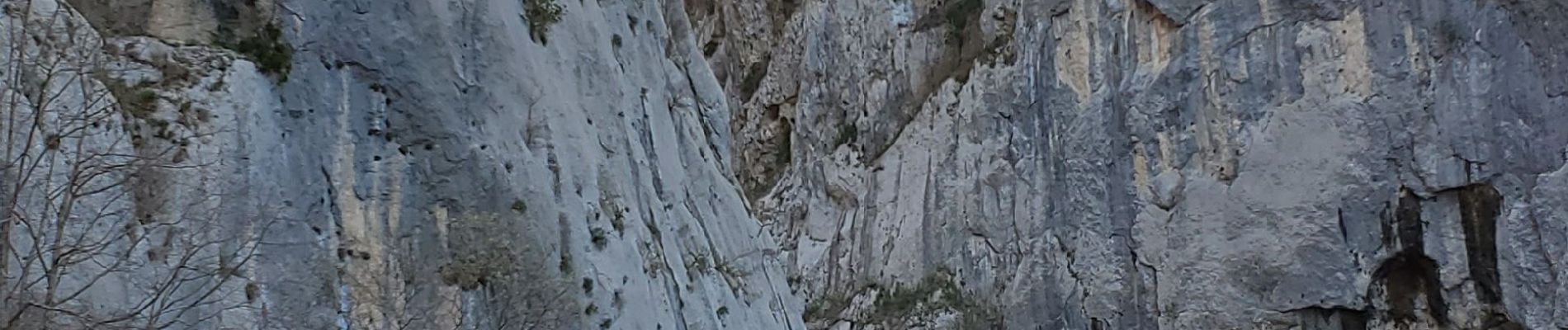
Trail Walking of 17 km to be discovered at Provence-Alpes-Côte d'Azur, Alpes-de-Haute-Provence, La Palud-sur-Verdon. This trail is proposed by Danielba .
Photos


Positioning
Country:
France
Region :
Provence-Alpes-Côte d'Azur
Department/Province :
Alpes-de-Haute-Provence
Municipality :
La Palud-sur-Verdon
Location:
Unknown
Start:(Dec)
Start:(UTM)
286322 ; 4847221 (32T) N.
Comments