


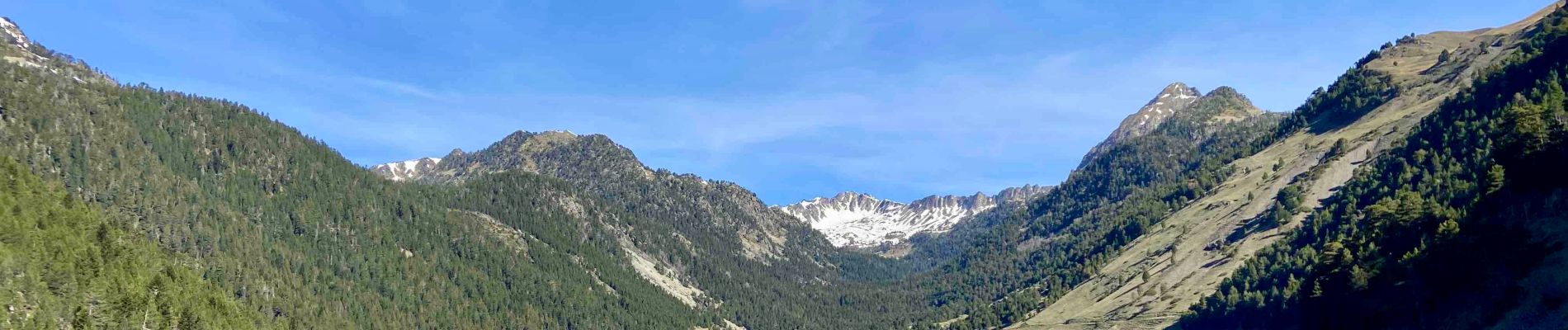
Lac d’Oule et Lac inférieur de Bastan

lebarça
User
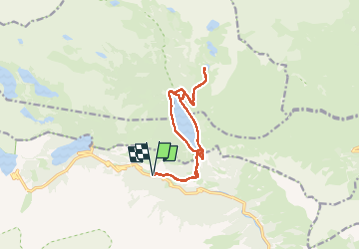

Length
15.2 km

Max alt
2155 m

Uphill gradient
699 m
Km-Effort
25 km

Min alt
1597 m

Downhill gradient
701 m
Boucle
Yes
Creation date :
2024-04-13 07:25:56.0
Updated on :
2024-04-13 17:27:54.438
5h34
Difficulty : Easy

FREE GPS app for hiking
 SityTrail
IGN / Geographical institutes
SityTrail Plus
The world is yours!
About
Trail Walking of 15.2 km to be discovered at Occitania, Hautespyrenees, Aragnouet. This trail is proposed by lebarça.
Photos

Positioning
Country:
France
Region :
Occitania
Department/Province :
Hautespyrenees
Municipality :
Aragnouet
Location:
Unknown
Start:(Dec)
Start:(UTM)
270310 ; 4744557 (31T) N.
Comments