


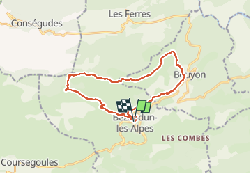
Bezaudun : Mont Estellier

ETMU5496
User

Length
15.8 km

Max alt
1267 m

Uphill gradient
809 m
Km-Effort
27 km

Min alt
667 m

Downhill gradient
809 m
Boucle
Yes
Creation date :
2024-04-14 06:36:44.0
Updated on :
2024-04-15 15:14:32.396
6h03
Difficulty : Very difficult

FREE GPS app for hiking
 SityTrail
IGN / Geographical institutes
SityTrail Plus
The world is yours!
About
Trail Walking of 15.8 km to be discovered at Provence-Alpes-Côte d'Azur, Maritime Alps, Bézaudun-les-Alpes. This trail is proposed by ETMU5496.
Photos


28 photos in total. Please click on a photo to see them all in the gallery.
Positioning
Country:
France
Region :
Provence-Alpes-Côte d'Azur
Department/Province :
Maritime Alps
Municipality :
Bézaudun-les-Alpes
Location:
Unknown
Start:(Dec)
Start:(UTM)
346847 ; 4852341 (32T) N.
Comments