


Gorges du Blavet

soca
User
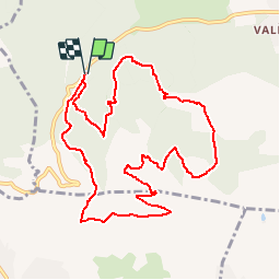

Length
11.3 km

Max alt
381 m

Uphill gradient
425 m
Km-Effort
17 km

Min alt
91 m

Downhill gradient
427 m
Boucle
Yes
Creation date :
2015-03-29 00:00:00.0
Updated on :
2015-03-29 00:00:00.0
3h41
Difficulty : Medium

FREE GPS app for hiking
 SityTrail
IGN / Geographical institutes
SityTrail Plus
The world is yours!
About
Trail Walking of 11.3 km to be discovered at Provence-Alpes-Côte d'Azur, Var, Bagnols-en-Forêt. This trail is proposed by soca.
Positioning
Country:
France
Region :
Provence-Alpes-Côte d'Azur
Department/Province :
Var
Municipality :
Bagnols-en-Forêt
Location:
Unknown
Start:(Dec)
Start:(UTM)
310533 ; 4822229 (32T) N.
Comments
