


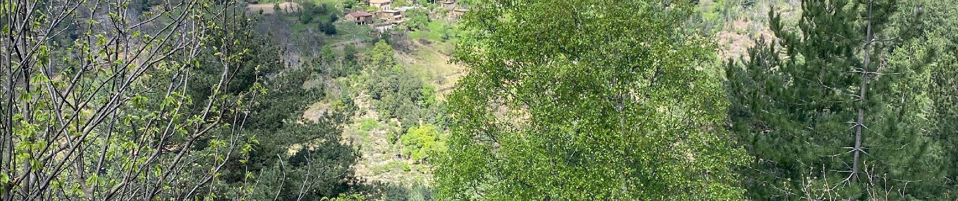
Aujac Malons et Elze

Roger Philippe Wallez
User GUIDE
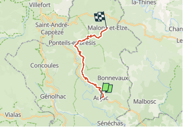

Length
16.4 km

Max alt
866 m

Uphill gradient
810 m
Km-Effort
26 km

Min alt
377 m

Downhill gradient
453 m
Boucle
No
Creation date :
2024-04-16 06:36:16.0
Updated on :
2024-04-16 12:45:36.048
6h02
Difficulty : Very difficult

FREE GPS app for hiking
 SityTrail
IGN / Geographical institutes
SityTrail Plus
The world is yours!
About
Trail Walking of 16.4 km to be discovered at Occitania, Gard, Aujac. This trail is proposed by Roger Philippe Wallez.
Photos


Positioning
Country:
France
Region :
Occitania
Department/Province :
Gard
Municipality :
Aujac
Location:
Unknown
Start:(Dec)
Start:(UTM)
580822 ; 4911057 (31T) N.
Comments