


Le sapey

andrechauvin
User

Length
18.2 km

Max alt
1462 m

Uphill gradient
852 m
Km-Effort
30 km

Min alt
722 m

Downhill gradient
851 m
Boucle
Yes
Creation date :
2024-04-16 08:04:17.923
Updated on :
2024-04-16 19:23:13.805
9h02
Difficulty : Medium

FREE GPS app for hiking
 SityTrail
IGN / Geographical institutes
SityTrail Plus
The world is yours!
About
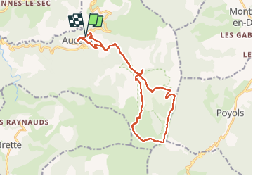
Trail Walking of 18.2 km to be discovered at Auvergne-Rhône-Alpes, Drôme, Aucelon. This trail is proposed by andrechauvin.
Description
très belle randonnée
Positioning
Country:
France
Region :
Auvergne-Rhône-Alpes
Department/Province :
Drôme
Municipality :
Aucelon
Location:
Unknown
Start:(Dec)
Start:(UTM)
686338 ; 4944100 (31T) N.
Comments